MD 0456 CONCERNING TORNADO WATCH 114…115… FOR EASTERN KS…SOUTHEAST NE…SOUTHWEST IA…FAR WESTERN MO Mesoscale Discussion 0456 NWS Storm Prediction Center Norman OK 0600 AM CDT Tue Apr 16 2024 Areas affected…Eastern KS…southeast NE…southwest IA…far western MO Concerning…Tornado Watch 114…115… Valid 161100Z – 161300Z The severe weather threat for Tornado Watch 114, 115 continues. SUMMARY…Isolated severe …
Continue reading SPC MD 456
Month:April 2024
Both iPhone 16 Pro Models to Feature 256GB Base Storage, Claims Sketchy Rumor
Apple will allegedly offer both the iPhone 16 Pro and iPhone 16 Pro Max with a minimum 256GB of storage, doing away with the 128GB starting option on its smaller Pro model for the first time. Currently, Apple’s 6.1-inch iPhone 15 Pro starts at $999 and comes with the minimum 128GB of storage, while the …
Continue reading Both iPhone 16 Pro Models to Feature 256GB Base Storage, Claims Sketchy Rumor
SPC Tornado Watch 115
WW 115 TORNADO KS 160930Z – 161400Z URGENT – IMMEDIATE BROADCAST REQUESTED Tornado Watch Number 115 NWS Storm Prediction Center Norman OK 430 AM CDT Tue Apr 16 2024 The NWS Storm Prediction Center has issued a * Tornado Watch for portions of Eastern Kansas * Effective this Tuesday morning from 430 AM until 900 …
Continue reading SPC Tornado Watch 115
SPC MD 455
MD 0455 CONCERNING SEVERE POTENTIAL…WATCH POSSIBLE FOR EASTERN KS Mesoscale Discussion 0455 NWS Storm Prediction Center Norman OK 0418 AM CDT Tue Apr 16 2024 Areas affected…Eastern KS Concerning…Severe potential…Watch possible Valid 160918Z – 161015Z Probability of Watch Issuance…60 percent SUMMARY…A couple severe storms may develop across eastern KS through sunrise with all hazards possible. …
Continue reading SPC MD 455
SPC Tornado Watch 113 Status Reports
WW 0113 Status Updates STATUS REPORT ON WW 113 SEVERE WEATHER THREAT CONTINUES RIGHT OF A LINE FROM 35 ENE RSL TO 25 W EAR. WW 113 IS SCHEDULED TO EXPIRE AT 160800Z. FOR ADDITIONAL INFORMATION SEE MESOSCALE DISCUSSION 0453. ..GRAMS..04/16/24 ATTN…WFO…DDC…ICT…GLD…GID…AMA…OUN… STATUS REPORT FOR WT 113 SEVERE WEATHER THREAT CONTINUES FOR THE FOLLOWING AREAS …
Continue reading SPC Tornado Watch 113 Status Reports
SPC MD 453
MD 0453 CONCERNING TORNADO WATCH 113… FOR SOUTH-CENTRAL/SOUTHEAST NE AND NORTH-CENTRAL/NORTHEAST KS Mesoscale Discussion 0453 NWS Storm Prediction Center Norman OK 0142 AM CDT Tue Apr 16 2024 Areas affected…South-central/southeast NE and north-central/northeast KS Concerning…Tornado Watch 113… Valid 160642Z – 160745Z The severe weather threat for Tornado Watch 113 continues. SUMMARY…Cluster of severe storms across …
Continue reading SPC MD 453
SPC Tornado Watch 114
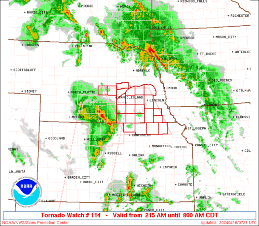
WW 114 TORNADO KS NE 160715Z – 161300Z URGENT – IMMEDIATE BROADCAST REQUESTED Tornado Watch Number 114 NWS Storm Prediction Center Norman OK 215 AM CDT Tue Apr 16 2024 The NWS Storm Prediction Center has issued a * Tornado Watch for portions of Northeast Kansas South-central and southeast Nebraska * Effective this Tuesday morning …
Continue reading SPC Tornado Watch 114
SPC MD 451
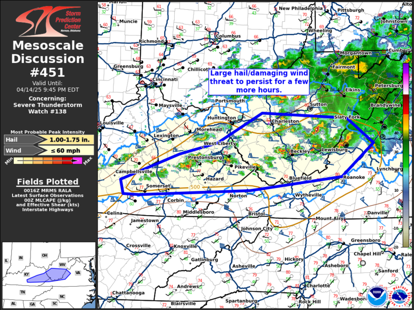
MD 0451 CONCERNING TORNADO WATCH 113… FOR PARTS OF WESTERN AND CENTRAL KANSAS AND ADJACENT SOUTH CENTRAL NEBRASKA Mesoscale Discussion 0451 NWS Storm Prediction Center Norman OK 1129 PM CDT Mon Apr 15 2024 Areas affected…parts of western and central Kansas and adjacent south central Nebraska Concerning…Tornado Watch 113… Valid 160429Z – 160630Z The severe …
Continue reading SPC MD 451
SPC Severe Thunderstorm Watch 112 Status Reports
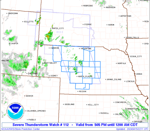
WW 0112 Status Updates STATUS REPORT ON WW 112 THE SEVERE WEATHER THREAT CONTINUES ACROSS THE ENTIRE WATCH AREA. WW 112 MAY BE ALLOWED TO EXPIRE AT 16/05Z. ..KERR..04/16/24 ATTN…WFO…LBF…GID… STATUS REPORT FOR WS 112 SEVERE WEATHER THREAT CONTINUES FOR THE FOLLOWING AREAS NEC005-009-017-031-041-063-071-075-091-103-111-113-115-117-149- 161-171-160500- NE . NEBRASKA COUNTIES INCLUDED ARE ARTHUR BLAINE BROWN CHERRY …
Continue reading SPC Severe Thunderstorm Watch 112 Status Reports
SPC Severe Thunderstorm Watch 111 Status Reports
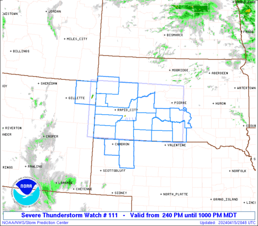
WW 0111 Status Updates STATUS REPORT ON WW 111 SEVERE WEATHER THREAT CONTINUES RIGHT OF A LINE FROM 15 NNE CDR TO 20 W RAP TO 25 NW 9V9. PARTS OF REMAING VALID PORTION OF WATCH NEAR THE NEBRASKA BORDER MAY BE LOCALLY EXTENDED AN HOUR. ..KERR..04/16/24 ATTN…WFO…CYS…LBF…UNR…ABR… STATUS REPORT FOR WS 111 SEVERE WEATHER …
Continue reading SPC Severe Thunderstorm Watch 111 Status Reports


