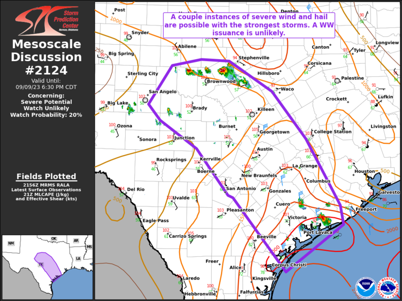
MD 2124 CONCERNING SEVERE POTENTIAL…WATCH POSSIBLE FOR PORTIONS OF NORTH TEXAS

Mesoscale Discussion 2124
NWS Storm Prediction Center Norman OK
0340 PM CDT Tue Sep 23 2025
Areas affected...Portions of North Texas
Concerning...Severe potential...Watch possible
Valid 232040Z - 232245Z
Probability of Watch Issuance...40 percent
SUMMARY...Large hail and severe gusts will be possible in parts of
North Texas. A watch is not currently anticipated, but convective
trends will be monitored for the possibility of a watch.
DISCUSSION...South of the upper-level trough, forcing for ascent is
weak. Even so, strong heating (temperatures near 100 F) have
promoted deepening cumulus within a prefrontal confluence band as
well as near a weak cold front/surface trough farther west. Given
observational trends, it appears probable that a few storms are
possible this afternoon. Coverage over the next two hours is not
certain. It may take the front moving southward to provide enough
lift for additional storms. A very moist airmass (upper 60s to low
70s dewpoints), moderately steep mid-level lapse rates sampled by
the 12Z FWD sounding and recent TAMDAR soundings, and around 30 kts
of effective shear suggests large hail would be possible. Severe
gusts could also occur given steep low-level lapse rates. Limited
coverage of storms may ultimately preclude a watch, but convective
trends near the DFW metro will be monitored into the evening.
..Wendt/Smith.. 09/23/2025
...Please see www.spc.noaa.gov for graphic product...
ATTN...WFO...FWD...OUN...SJT...
LAT...LON   32009807 31909870 32059938 32299956 33419864 33549816
            33509786 33279725 33059676 32849682 32499715 32009807
MOST PROBABLE PEAK WIND GUST...55-70 MPH
MOST PROBABLE PEAK HAIL SIZE...1.00-1.75 IN
