
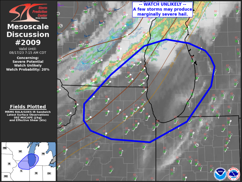
MD 2009 CONCERNING SEVERE POTENTIAL…WATCH UNLIKELY FOR NORTHERN ILLINOIS AND SOUTHEAST WISCONSIN ACROSS SOUTHERN LAKE MICHIGAN
Mesoscale Discussion 2009
NWS Storm Prediction Center Norman OK
0441 AM CDT Thu Aug 17 2023
Areas affected…northern Illinois and southeast Wisconsin across
southern Lake Michigan
Concerning…Severe potential…Watch unlikely
Valid 170941Z – 171215Z
Probability of Watch Issuance…20 percent
SUMMARY…Storms may increase in coverage and intensity along the
cold front this morning, possibly producing sporadic, marginally
severe hail.
DISCUSSION…A strong shortwave trough continues to move eastward
toward the Upper Great Lakes, with pronounced cooling aloft.
However, instability, especially surface-based, is lacking with a
relatively cool boundary layer in place. An elevated moisture source
is present though, with GPS PW sensors indicating a narrow plume of
over 1.50″ where the existing line of storms is. Objective analysis
is analyzing MUCAPE over 1000 J/kg, again above the stable/capped
surface layer.
Upstream soundings from last evening confirm the cool temperatures
aloft with steep lapse rates present, along with strong deep-layer
shear. While damaging winds appear unlikely with this activity in
the near term, hail may occur in the stronger cores within the line,
which is forecast to back build over the next few hours. Recent
radar trends confirm this prognosis, with increasing echo tops as
well as storms now developing toward the MS River. As such, strong
storms will likely impact much of the Chicago area later this
morning, and perhaps into northern IN and southwest Lower MI.
..Jewell/Edwards.. 08/17/2023
…Please see www.spc.noaa.gov for graphic product…
ATTN…WFO…IWX…GRR…LOT…MKX…DVN…
LAT…LON 42498569 41638651 41138772 41208897 41408966 41648989
42058989 42798902 43498790 43658717 43568641 43368585
43218569 42978555 42498569