
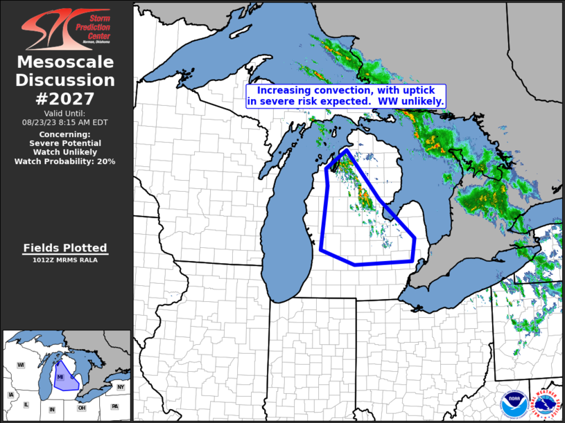
MD 2027 CONCERNING SEVERE POTENTIAL…WATCH UNLIKELY FOR LOWER MICHIGAN
Mesoscale Discussion 2027
NWS Storm Prediction Center Norman OK
0514 AM CDT Wed Aug 23 2023
Areas affected…Lower Michigan
Concerning…Severe potential…Watch unlikely
Valid 231014Z – 231215Z
Probability of Watch Issuance…20 percent
SUMMARY…Storms are forecast to continue increasing in coverage
across Lower Michigan over the next couple of hours, but any severe
risk should remain limited/isolated, and mainly in the form of
marginal hail.
DISCUSSION…Latest radar loop shows a steady increase in convective
coverage over the past hour or so across northern lower Michigan, in
line with expectations and with CAM guidance. The convection is
evolving within an environment featuring 500 J/kg (east) to 1500
J/kg (west) elevated CAPE based at roughly 850mb, atop a cool/stable
boundary layer. Warm advection — associated with a westerly
low-level jet — is providing ascent, supporting the observed
development.
While deep-layer shear — comprised of weakly veering/increasing
flow with height through the cloud-bearing layer — is plenty
sufficient for organized convection, severe risk should remain
limited at best. Hail, emanating from a couple of the strongest
storms, remains the most likely risk, with maximum hail size
expected to remain in the 1″ to 1 1/2″ range. Meanwhile, though
gusty winds can also be expected, the degree of stability within the
roughly 1.5km deep sub-cloud layer (where temperatures are in the
lower to mid 60s and dewpoints in the mid to upper 50s), should
limit potential for wind gusts in excess of severe levels reaching
the surface.
..Goss/Guyer.. 08/23/2023
…Please see www.spc.noaa.gov for graphic product…
ATTN…WFO…DTX…APX…GRR…
LAT…LON 44828581 45268512 44098405 43188292 42638300 42558486
42908595 44428574 44828581