
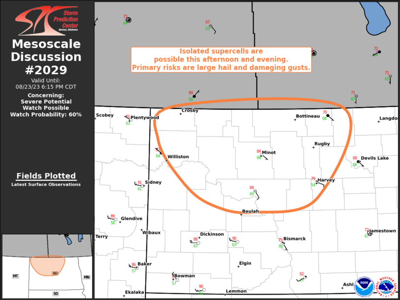
MD 2029 CONCERNING SEVERE POTENTIAL…WATCH POSSIBLE FOR NORTHWEST/NORTH-CENTRAL ND
Mesoscale Discussion 2029
NWS Storm Prediction Center Norman OK
0343 PM CDT Wed Aug 23 2023
Areas affected…Northwest/North-Central ND
Concerning…Severe potential…Watch possible
Valid 232043Z – 232315Z
Probability of Watch Issuance…60 percent
SUMMARY…Isolated supercells are possible this afternoon and
evening across northwest/north-central ND. Primary severe risks with
any mature storms are large hail and damaging gusts.
DISCUSSION…Recent surface analysis places a low in far northwest
ND, approximately 50 miles north of ISN. Visible satellite shows
some deeper cumulus in the vicinity of this low, with some
additional shallower cumulus ahead of it. The air mass across the
region continues to destabilize amid strong heating and dewpoints in
the upper 60s/low 70s. Recent mesoanalysis estimates MLCAPE is near
1500 J/kg just downstream of the surface low. Moderate mid-level
flow stretches across this region as well, which is contributing to
moderate/strong vertical shear. Recent mesoanalysis estimates
effective bulk shear around 40-45 kt is currently in place. This
moderate mid-level flow and associated moderate/strong shear is
expected to persist across the region through the evening.
Given these environmental conditions, a conditional risk of a
supercell or two exists. Main uncertainty is whether or not updrafts
can be maintained amid the potential entrainment of moderately warm
and dry mid-level air. Current expectation is that at least a few
storms should be able to persist, although, given the subtle
forcing, it could be a few hours before updrafts are able to mature.
Any storms that do mature/persist would likely become supercellular
with a subsequent risk for large hail and/or damaging gusts.
..Mosier/Grams.. 08/23/2023
…Please see www.spc.noaa.gov for graphic product…
ATTN…WFO…FGF…BIS…
LAT…LON 48450383 49030342 49009924 47529992 47300149 47380238
47710309 48450383