
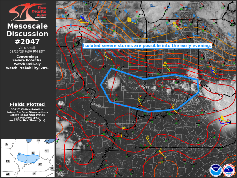
MD 2047 CONCERNING SEVERE POTENTIAL…WATCH UNLIKELY FOR PARTS OF SOUTHERN IL/IN
Mesoscale Discussion 2047
NWS Storm Prediction Center Norman OK
0325 PM CDT Fri Aug 25 2023
Areas affected…Parts of southern IL/IN
Concerning…Severe potential…Watch unlikely
Valid 252025Z – 252230Z
Probability of Watch Issuance…20 percent
SUMMARY…Isolated severe storms are possible later this afternoon
into the evening, with a threat of locally damaging wind and perhaps
some hail.
DISCUSSION…A strong thunderstorm has recently developed across
south-central IL, with an increasing cumulus field noted farther
east along a surface boundary into southeast IL and southern IN.
Strong to extreme buoyancy has developed within a very hot/moist
environment, with MLCAPE in the 3000-4500 J/kg range per recent
mesoanalyses and also noted regionally on the 18 UTC ILN sounding.
While deep-layer shear is rather weak (with effective shear
generally less than 25 kt), the favorable buoyancy will support a
threat of isolated hail and localized downbursts with any sustained
development through the afternoon. Storm coverage through the
afternoon remains somewhat uncertain, with generally limited
large-scale ascent and weak convergence along the boundary. With the
threat expected to remain somewhat isolated, watch issuance in the
short-term is considered unlikely.
..Dean/Thompson.. 08/25/2023
…Please see www.spc.noaa.gov for graphic product…
ATTN…WFO…ILN…LMK…IND…PAH…ILX…LSX…
LAT…LON 39808935 39378766 39558605 39338490 38848482 38178595
38078740 38458936 38918970 39128986 39808935