
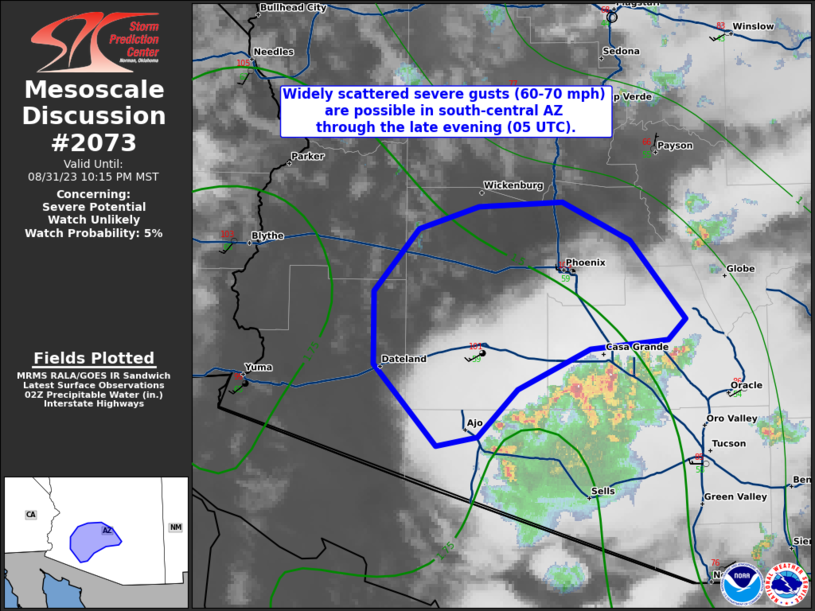
MD 2073 CONCERNING SEVERE POTENTIAL…WATCH UNLIKELY FOR SOUTH-CENTRAL AZ
Mesoscale Discussion 2073
NWS Storm Prediction Center Norman OK
0942 PM CDT Thu Aug 31 2023
Areas affected…south-central AZ
Concerning…Severe potential…Watch unlikely
Valid 010242Z – 010515Z
Probability of Watch Issuance…5 percent
SUMMARY…Widely scattered severe gusts (60-70 mph) are possible in
south-central AZ through the late evening (05 UTC) as an organized
linear thunderstorm cluster slowly moves northwest. Upon
coordination with NWS Phoenix, a small severe thunderstorm watch
will not be issued due primarily to the small spatial/temporal
nature of the severe-wind threat.
DISCUSSION…Radar mosaic shows a linear cluster of thunderstorms
over southern AZ moving slowly northwest across the Sonoran Desert
this evening. The 22 UTC 1Y7 (Yuma) raob did sample the
moisture/buoyancy reservoir that increases from east to west across
southern AZ. The 00 UTC Tucson and Phoenix raobs showed very steep
lapse rates from the surface to 500 mb. Although diurnal heating
has abated, hot conditions persist with temperatures near 100 deg F
northwest of the ongoing storms as of 0240 UTC. The Pinal Airport
AWOS (KMZJ) recently measured a 50-kt gust at 0150 UTC with this
activity.
The KIWA VAD (Phoenix 88D) has shown a strengthening in
southeasterly flow around 500 mb (less than 5 kt to 30-35 kt). This
enhancement in mid-level flow was observed subtly on the KEMX VAD
(Tucson 88D) and the 00 UTC Tucson raob. Given the organized
character of the linear thunderstorm cluster, expecting the enhanced
belt of mid-level flow and cold pool organization to aid in this
activity to slowly move into the greater Phoenix vicinity over the
next few hours. The stronger downdrafts will probably be capable of
severe gusts (60-70 mph).
..Smith/Grams.. 09/01/2023
…Please see www.spc.noaa.gov for graphic product…
ATTN…WFO…TWC…FGZ…PSR…
LAT…LON 32251308 32801359 33291358 33711323 33861275 33891207
33631153 33111109 32971123 32901185 32641243 32321276
32251308