
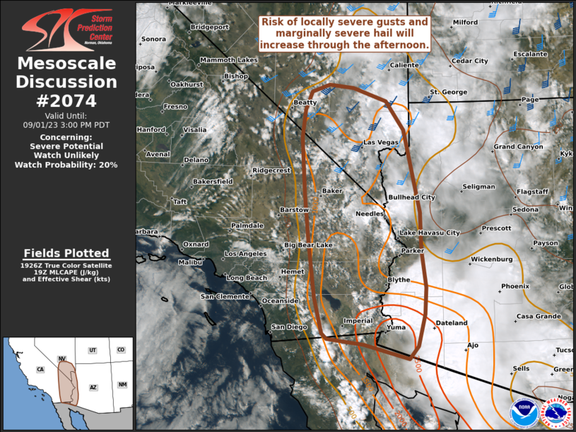
MD 2074 CONCERNING SEVERE POTENTIAL…WATCH UNLIKELY FOR PORTIONS OF THE LOWER CO RIVER VALLEY AND SOUTHEASTERN CA
Mesoscale Discussion 2074
NWS Storm Prediction Center Norman OK
0231 PM CDT Fri Sep 01 2023
Areas affected…Portions of the Lower CO River Valley and
southeastern CA
Concerning…Severe potential…Watch unlikely
Valid 011931Z – 012200Z
Probability of Watch Issuance…20 percent
SUMMARY…Thunderstorms should gradually increase in coverage and
intensity through the afternoon. Locally severe gusts and marginally
severe hail are possible with the stronger storms.
DISCUSSION…Cloud clearing/thinning in the wake of morning
convection is yielding ample diurnal heating/destabilization of a
moist air mass (1.5+ inch PW and middle/upper 60s to lower 70s
surface dewpoints) over portions of the Lower CO River Valley and
southeastern CA. At the same time, midlevel ascent peripheral to a
large-scale mid/upper-level low over the Northwest will support
steepening midlevel lapse rates atop the destabilizing boundary
layer. In the near-term, a cluster of thunderstorms will continue
evolving north-northwestward along an outflow boundary in
southwestern AZ. While modest deep-layer shear (around 20 kt of 0-6
km bulk shear per regional VWP data) could favor outflow-dominant
storms, moderate surface-based instability — characterized by
deep/rich moisture and diurnally steepening low-level lapse rates —
will support strong to locally severe gusts and sporadic hail.
Through the remainder of the afternoon, additional thunderstorm
development (possibly outflow dominant with southward extent) is
expected along terrain features and differential heating zones —
aided by the glancing large-scale ascent. Minimal convective
inhibition and the aforementioned rich/deep moisture should promote
numerous thunderstorms and related cell interactions/mergers. Strong
to severe gusts are the main concern with any clusters that develop
in this environment, though marginally severe hail cannot be ruled
out with the more-separated updrafts. As storms develop/spread
northward into southern NV — where a belt of stronger midlevel
southwesterlies and related deep-layer shear is in place —
increasingly organized storm structures (including
transient/embedded supercells and clusters) could evolve. However,
this will be dependent on the degree of surface-based
heating/destabilization, which will generally be maximized over
areas farther south.
..Weinman/Mosier.. 09/01/2023
…Please see www.spc.noaa.gov for graphic product…
ATTN…WFO…PSR…VEF…SGX…
LAT…LON 32481508 32591591 32691602 33371619 34431634 35301642
36341650 36871643 37201627 37341587 37281533 37021458
36481417 34951382 34251379 33541369 33041372 32451387
32221408 32481508