
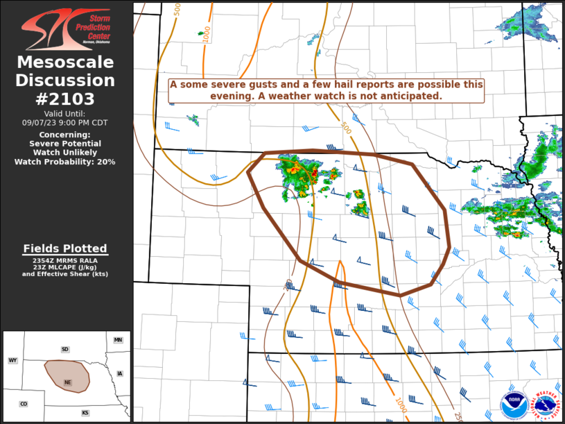
MD 2103 CONCERNING SEVERE POTENTIAL…WATCH UNLIKELY FOR NORTH-CENTRAL NE
Mesoscale Discussion 2103
NWS Storm Prediction Center Norman OK
0657 PM CDT Thu Sep 07 2023
Areas affected…north-central NE
Concerning…Severe potential…Watch unlikely
Valid 072357Z – 080200Z
Probability of Watch Issuance…20 percent
SUMMARY…Some severe gusts and a few hail reports are possible this
evening across parts of north-central Nebraska. A watch is not
anticipated.
DISCUSSION…A cluster of storms has been ongoing across southern
South Dakota, moving into northern Nebraska, and additional storms
are developing along a warm front across the region near an
upper-level shortwave trough. South of the boundary, temperatures
are in the mid-80s to near 90F with dewpoints in the low 50s, and
per short-term RAP profiles, inverted-V low-level thermodynamic
profiles are common across central Nebraska. Additionally, mid-level
flow from the trough is producing effective bulk shear of 40 kts
with straight hodographs. Given the low-level thermodynamic
profiles, some severe gusts are possible, and a few hail reports are
possible with the deep-layer shear. The limiting factor is buoyancy,
with 500-1000 J/kg MLCAPE, and for this reason a watch is not
anticipated. With support from the upper-level trough, storms are
expected to sustain past sunset, moving to the east and southeast.
..Supinie/Thompson.. 09/07/2023
…Please see www.spc.noaa.gov for graphic product…
ATTN…WFO…OAX…GID…LBF…UNR…
LAT…LON 42980180 43030082 42979959 42829881 42139816 41589808
41329822 41039847 40879906 41070028 41380106 42160181
42690213 42980180