
MD 2137 CONCERNING SEVERE POTENTIAL…WATCH POSSIBLE FOR PARTS OF EASTERN NEW MEXICO INTO THE TEXAS SOUTH PLAINS
Mesoscale Discussion 2137
NWS Storm Prediction Center Norman OK
0233 PM CDT Mon Sep 11 2023
Areas affected…parts of eastern New Mexico into the Texas South
Plains
Concerning…Severe potential…Watch possible
Valid 111933Z – 112130Z
Probability of Watch Issuance…60 percent
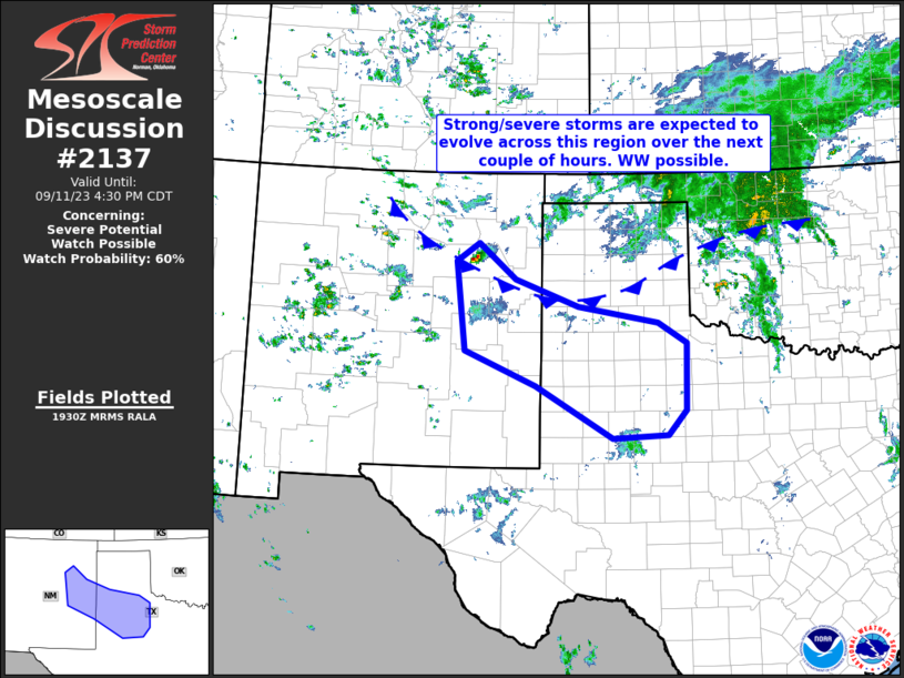
SUMMARY…Thunderstorms are forecast to gradually develop over the
next couple of hours across portions of east-central New Mexico, and
into the adjacent Texas South Plains region. WW issuance may be
needed in the next hour or so.
DISCUSSION…Latest radar loop shows a lone thunderstorm evolving
over San Miguel county in New Mexico at this time. The storm is
occurring along what appears to be a cold frontal surge, per surface
obs and visible satellite imagery, where daytime heating has boosted
mixed-layer CAPE to near 1000 J/kg. Extending east-southeastward
from this storm, along and south of the frontal surge and within an
axis of instability that increases to 1500 J/kg mixed-layer CAPE
over the Texas South Plains, an increasingly agitated cu field is
apparent within visible imagery, supporting CAM guidance that
suggests more widespread storm development over the next few hours.
As enhanced (40-plus kt) mid-level west-northwesterly flow spreads
eastward out of New Mexico atop low-level south-southwesterlies
observed over the South Plains, a kinematic environment supportive
of organized/rotating storms is apparent. As storms evolve,
potential for large hail, and locally gusty winds, will increase.
While the largest hail will be associated with any more
isolated/rotating storms, wind risk would maximize with any
upscale-growing clusters of storms which may gradually evolve and
spread east-southeastward across the area. The anticipated
convective evolution suggests that WW issuance may be needed before
4 PM CDT/3PM MDT.
..Goss/Guyer.. 09/11/2023
…Please see www.spc.noaa.gov for graphic product…
ATTN…WFO…SJT…LUB…AMA…MAF…ABQ…
LAT…LON 35500479 35810433 35190357 34730229 34450065 34110008
32960010 32540048 32490160 33380316 33970461 35500479