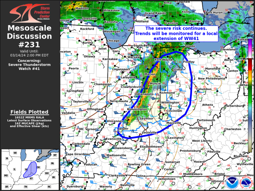
MD 0231 CONCERNING SEVERE THUNDERSTORM WATCH 41… FOR PARTS IF EASTERN IN…WESTERN AND CENTRAL OHIO AND FAR NORTHERN KENTUCKY
Mesoscale Discussion 0231
NWS Storm Prediction Center Norman OK
1155 AM CDT Thu Mar 14 2024
Areas affected…parts if eastern IN…western and central Ohio and
far northern Kentucky
Concerning…Severe Thunderstorm Watch 41…
Valid 141655Z – 141800Z
The severe weather threat for Severe Thunderstorm Watch 41
continues.
SUMMARY…The severe risk across WW41 continues. Some downstream
local extension is possible in the next hour or two.
DISCUSSION…As of 1650 UTC, a well-developed squall line was
ongoing across eastern IN nearing the OH border. These storms have
produced numerous reports of small hail and occasional strong gusts
over the last couple of hours. The line of storms should continue
eastward crossing into OH within the next hour and remain capable of
isolated severe gusts. Ahead of the line, drier air is in place and
buoyancy decreases quickly across central OH. As the line begins to
enter the more stable air later this afternoon a gradual downtrend
in convective intensity is likely. Still, the line has remained well
organized thus far and is likely capable of damaging gusts and small
hail. With this in mind, the eastern extent of the severe risk
remains somewhat unclear. As the line moves into OH, a local
extension of WW41 may be needed across parts of central OH before it
weakens further.
..Lyons/Goss.. 03/14/2024
…Please see www.spc.noaa.gov for graphic product…
ATTN…WFO…CLE…ILN…LMK…IWX…IND…
LAT…LON 39588598 40818527 41378469 41528397 41468364 41068331
40498318 39888322 39448329 39058354 38728410 38388481
38268525 38178579 38108640 38148670 38318692 38638688
39588598
