
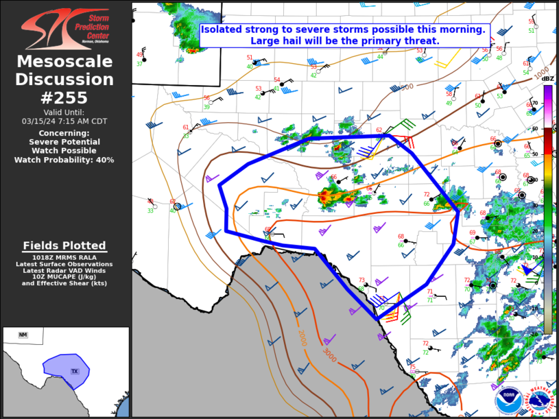
MD 0255 CONCERNING SEVERE POTENTIAL…WATCH POSSIBLE FOR PARTS OF SOUTHWEST TX
Mesoscale Discussion 0255
NWS Storm Prediction Center Norman OK
0521 AM CDT Fri Mar 15 2024
Areas affected…Parts of southwest TX
Concerning…Severe potential…Watch possible
Valid 151021Z – 151215Z
Probability of Watch Issuance…40 percent
SUMMARY…Isolated strong to potentially severe storms possible this
morning. Large hail will be the primary threat.
DISCUSSION…Convection is gradually increasing across parts of
southwest TX this morning. This activity is possibly being aided by
a subtle midlevel vorticity maximum moving out of northeast Mexico,
and some increase in storm coverage and intensity will be possible
over the next few hours. Low-level east/northeasterly flow has
transported relatively rich low-level moisture beneath steep
midlevel lapse rates, with MUCAPE increasing into the 1500-2000 J/kg
range per recent objective mesoanalyses. Midlevel flow is not overly
strong, but low-level easterlies veering to southwesterly aloft are
supporting effective shear of greater than 40 kt, and a supercell or
two could evolve with time this morning if storms can mature within
the subtly forced environment.
Large hail (potentially in the 1.5 – 2 inch diameter range) will
likely be the primary hazard. Coverage of the severe threat may
remain rather isolated through the morning, but watch issuance is
possible if multiple strong/severe storms appear imminent.
..Dean/Thompson.. 03/15/2024
…Please see www.spc.noaa.gov for graphic product…
ATTN…WFO…EWX…SJT…MAF…
LAT…LON 29890204 29930231 30070292 30370292 30670303 30960260
31320166 31350041 31110006 30339936 29909944 29379986
28900061 29310106 29840155 29890204