
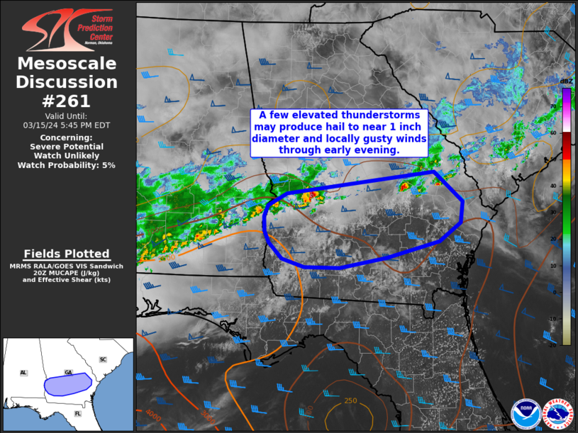
MD 0261 CONCERNING SEVERE POTENTIAL…WATCH UNLIKELY FOR PORTIONS OF SOUTHERN GA
Mesoscale Discussion 0261
NWS Storm Prediction Center Norman OK
0309 PM CDT Fri Mar 15 2024
Areas affected…portions of southern GA
Concerning…Severe potential…Watch unlikely
Valid 152009Z – 152145Z
Probability of Watch Issuance…5 percent
SUMMARY…Isolated thunderstorms near a southward-sagging front may
produce sporadic hail to near 1 inch in diameter and locally gusty
winds through early evening. A watch is not expected at this time.
DISCUSSION…Isolated thunderstorms ongoing near a southward-sagging
boundary will continue into early evening. MUCAPE around 500-1000
J/kg amid moderate 0-6 km effective shear will support organized
cells. Most of this activity appears somewhat elevated just to the
cool side of the surface boundary and forcing across the area is
expected to remain weak/unfocused. However, RAP forecast soundings
indicate elongated/straight hodographs and modest midlevel lapse
rates. This will continue to support sporadic instances of hail to
near 1 inch in diameter. If any storms can develop ahead of the
boundary or remain anchored to the front, steep low-level lapse
rates across southern GA may support strong gusts as well. At this
time, severe potential/storm coverage is expected to remain low and
a watch is not expected at this time.
..Leitman/Goss.. 03/15/2024
…Please see www.spc.noaa.gov for graphic product…
ATTN…WFO…CHS…JAX…FFC…TAE…BMX…
LAT…LON 32318468 32648199 32188147 31858151 31568190 31308285
31158372 31158437 31288477 31548502 31728509 31958510
32118503 32318468