
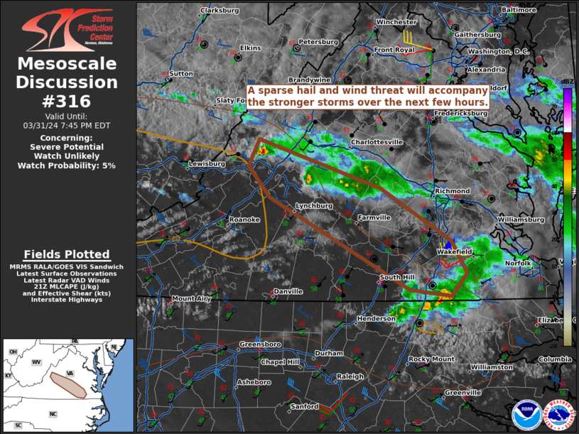
MD 0316 CONCERNING SEVERE POTENTIAL…WATCH UNLIKELY FOR PORTIONS OF CENTRAL VIRGINIA
Mesoscale Discussion 0316
NWS Storm Prediction Center Norman OK
0443 PM CDT Sun Mar 31 2024
Areas affected…portions of central Virginia
Concerning…Severe potential…Watch unlikely
Valid 312143Z – 312345Z
Probability of Watch Issuance…5 percent
SUMMARY…A couple instances of hail and perhaps strong wind gusts
will accompany the stronger storms over the next few hours. The
severe threat is expected to remain isolated into the evening hours.
DISCUSSION…Multiple discrete storms (possibly small supercells)
have been percolating in intensity over the past hour or so, as seen
by MRMS mosaic radar data. These storms are traversing a diffuse
effective warm front, where at least upper 50s F surface dewpoints
and steep low-level lapse rates are contributing up to 500 J/kg of
thin MLCAPE. RAP forecast soundings and regional VADs show
relatively straight, elongated hodographs, which favor a continued
discrete storm mode with persistent enough mid-level rotation to
foster some hail production. A couple of strong wind gusts are also
possible given the steep low-level lapse rates. The severe threat
should remain sparse and localized into the evening hours, when a
weakening trend is expected given nocturnal cooling.
..Squitieri/Guyer.. 03/31/2024
…Please see www.spc.noaa.gov for graphic product…
ATTN…WFO…AKQ…LWX…RNK…
LAT…LON 38107956 37637809 37127725 36817705 36587724 36647775
37117863 37547944 37837970 38107956