
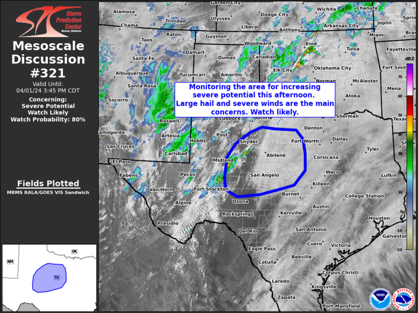
MD 0321 CONCERNING SEVERE POTENTIAL…WATCH LIKELY FOR PARTS OF WEST AND CENTRAL TEXAS
Mesoscale Discussion 0321
NWS Storm Prediction Center Norman OK
0213 PM CDT Mon Apr 01 2024
Areas affected…Parts of west and central Texas
Concerning…Severe potential…Watch likely
Valid 011913Z – 012045Z
Probability of Watch Issuance…80 percent
SUMMARY…Monitoring the area for increasing severe-storm potential.
Large hail and severe gusts are the main concerns. A watch is likely
in the next 30 minutes or so.
DISCUSSION…Isolated storms are developing along the dryline this
afternoon, and this activity will generally spread
east-northeastward through the afternoon — in conjunction with an
approaching lobe of midlevel ascent. While initial storms may be
high-based with a localized severe risk, the risk will gradually
increase over the next few hours as storms move into moderate/strong
surface-based buoyancy and rapidly increasing deep-layer shear.
Generally straight hodographs will favor large to very large hail
and severe winds with supercells and organized clusters. A watch is
likely in the next 30 minutes or so.
..Weinman/Thompson.. 04/01/2024
…Please see www.spc.noaa.gov for graphic product…
ATTN…WFO…FWD…SJT…LUB…MAF…
LAT…LON 31450151 32240142 32750107 33190040 33399988 33339928
33279834 32929804 32379797 31769798 31209847 31039919
30879994 30780094 31030144 31450151