
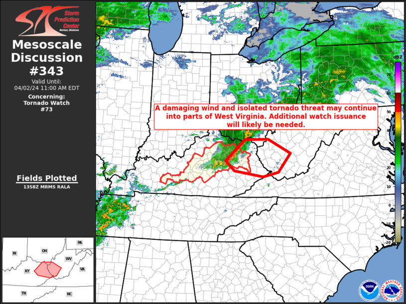
MD 0343 CONCERNING TORNADO WATCH 73… FOR PORTIONS OF EASTERN KY…EXTREME SOUTHERN OH…EXTREME SOUTHWESTERN VA…AND WV
Mesoscale Discussion 0343
NWS Storm Prediction Center Norman OK
0900 AM CDT Tue Apr 02 2024
Areas affected…Portions of eastern KY…extreme southern
OH…extreme southwestern VA…and WV
Concerning…Tornado Watch 73…
Valid 021400Z – 021500Z
The severe weather threat for Tornado Watch 73 continues.
SUMMARY…A damaging wind and isolated tornado threat may continue
into parts of West Virginia this morning. Downstream watch issuance
will be needed.
DISCUSSION…A small, but well organized line of thunderstorms is
ongoing this morning across parts of eastern KY and far southern OH.
While instability remains weak per recent mesoanalysis estimates and
various RAP forecast soundings (around 250-500 J/kg MLCAPE), strong
deep-layer shear of 50-60 kt will likely support continued
convective organization as this line moves eastward into parts of WV
and vicinity this morning. Damaging winds should remain the primary
threat given the linear nature of the ongoing convection, but enough
low-level shear is also present to support some risk for isolated
tornadoes. A downstream watch will be issued shortly.
..Gleason/Thompson.. 04/02/2024
…Please see www.spc.noaa.gov for graphic product…
ATTN…WFO…RLX…JKL…ILN…LMK…
LAT…LON 37908400 38668314 38678209 38168108 37498163 37338231
37548361 37908400