
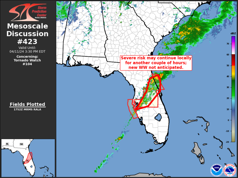
MD 0423 CONCERNING TORNADO WATCH 104… FOR CENTRAL FLORIDA
Mesoscale Discussion 0423
NWS Storm Prediction Center Norman OK
1254 PM CDT Thu Apr 11 2024
Areas affected…central Florida
Concerning…Tornado Watch 104…
Valid 111754Z – 111930Z
The severe weather threat for Tornado Watch 104 continues.
SUMMARY…Potential for gusty winds and a brief tornado may continue
locally over the next couple of hours, but new WW issuance is not
anticipated. Local WW extensions may be needed for a short time, to
cover any lingering threat beyond the scheduled 11/19Z expiration of
WW 104.
DISCUSSION…Strong storms continue crossing central portions of the
Florida Peninsula at this time, within a band extending from north
of Daytona Beach to near Sarasota. Storms have shown an overall,
gradual decrease in organization, in part likely due to low-level
veering of the winds ahead of the band. With little in the way of
additional destabilization anticipated ahead of the convection,
steady or gradually decreasing severe-weather potential seems
likely. Still, a locally stronger storm or two will remain capable
of producing a damaging gust or brief tornado this afternoon.
..Goss.. 04/11/2024
…Please see www.spc.noaa.gov for graphic product…
ATTN…WFO…MLB…TBW…JAX…
LAT…LON 27478254 28708176 29618148 29848082 29488066 28758069
27708162 27478254