
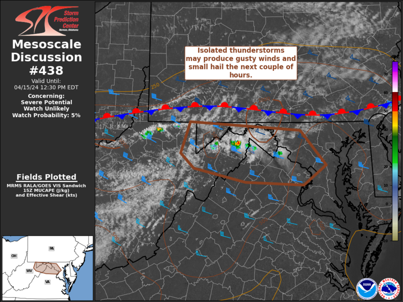
MD 0438 CONCERNING SEVERE POTENTIAL…WATCH UNLIKELY FOR PORTIONS OF EASTERN WEST VIRGINIA…NORTHERN VIRGINIA AND WESTERN MARYLAND
Mesoscale Discussion 0438
NWS Storm Prediction Center Norman OK
1001 AM CDT Mon Apr 15 2024
Areas affected…portions of eastern West Virginia…northern
Virginia and western Maryland
Concerning…Severe potential…Watch unlikely
Valid 151501Z – 151630Z
Probability of Watch Issuance…5 percent
SUMMARY…Isolated showers and thunderstorms may produce gusty winds
or small hail the next couple of hours across parts of the West
Virginia, Maryland and Virginia border vicinity.
DISCUSSION…A couple of thunderstorms have developed late this
morning ahead of a stationary boundary near the WV/MD/VA border.
This activity is likely somewhat elevated. Nevertheless, weak
instability (generally less than 500 J/kg MUCAPE) amid steep
midlevel lapse rates and modest effective shear could support
sporadic small hail. A dry, mixed boundary-layer and light low-level
flow also may foster gusty winds around 40-50 mph. This initial
thunderstorm activity is expected to remain isolated and the overall
severe threat limited over the next couple of hours, and a watch is
not expected. The severe threat will increase across portions of
Mid-Atlantic later this afternoon, and this later threat will be
addressed with additional MCDs in the coming hours.
..Leitman/Smith.. 04/15/2024
…Please see www.spc.noaa.gov for graphic product…
ATTN…WFO…LWX…PBZ…RLX…
LAT…LON 39737960 39597725 39007670 38677719 38727842 38957953
39207981 39737960