
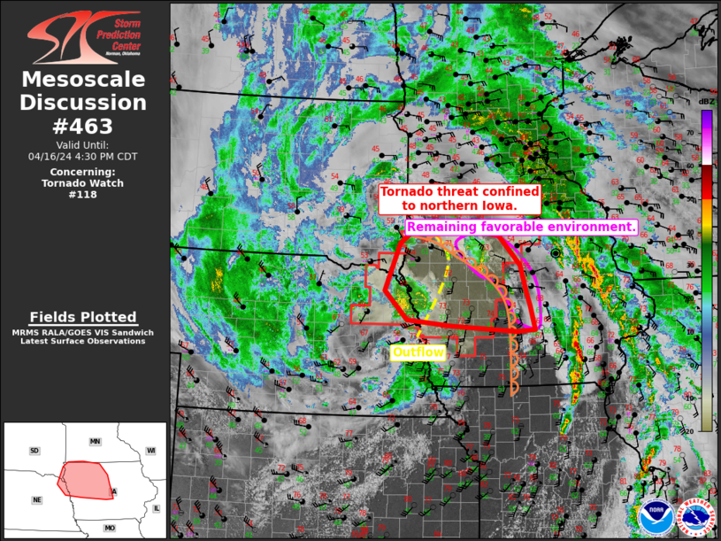
MD 0463 CONCERNING TORNADO WATCH 118… FOR NORTHERN IOWA
Mesoscale Discussion 0463
NWS Storm Prediction Center Norman OK
0336 PM CDT Tue Apr 16 2024
Areas affected…Northern Iowa
Concerning…Tornado Watch 118…
Valid 162036Z – 162130Z
The severe weather threat for Tornado Watch 118 continues.
SUMMARY…The tornado threat within watch 118 is now confined to
northern Iowa.
DISCUSSION…As the Pacific front interacted with convection across
eastern Nebraska around 19Z, a strong outflow boundary pushed well
ahead of convection which has essentially ended the severe weather
threat for the western half of watch 118. In addition, this outflow
boundary has recently collided with the warm front near the
intersection of MN/IA/SD and thus, expect the storm which moved
north of the boundary to continue to weaken.
Therefore, the only remaining favorable airmass is northeast of the
dryline across north-central Iowa. In this region, a few tornadoes
have been confirmed with the low-topped supercell in Pocahontas
county at 2030Z. Visible satellite and radar trends show additional
storms developing southeast of this storm which may also pose a
tornado threat this afternoon and into the early evening as they
move north.
..Bentley.. 04/16/2024
…Please see www.spc.noaa.gov for graphic product…
ATTN…WFO…MPX…DMX…FSD…OAX…
LAT…LON 41609365 41729530 41839642 42379699 43279660 43529626
43559523 43429408 42869354 42369339 42089329 41649317
41609365