
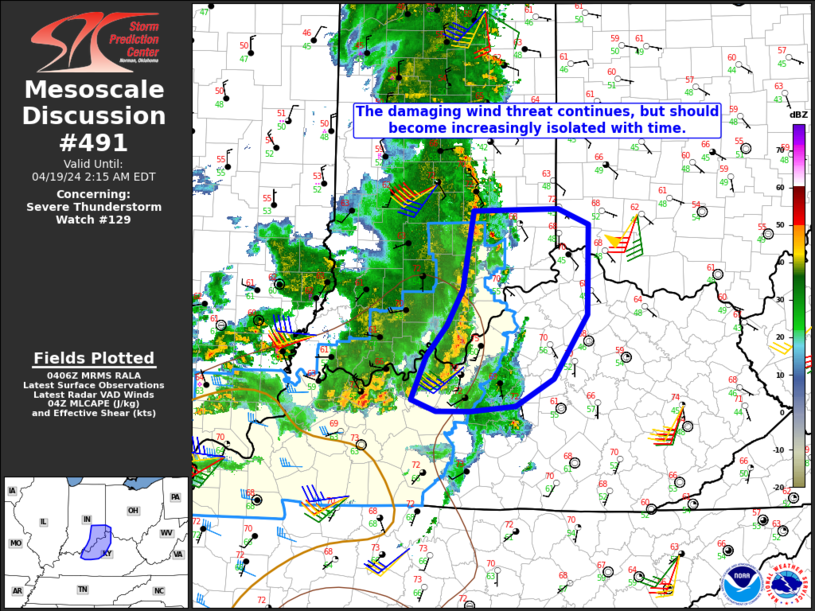
MD 0491 CONCERNING SEVERE THUNDERSTORM WATCH 129… FOR PARTS OF SOUTHEAST IN…NORTHERN KY…FAR SOUTHWEST OH
Mesoscale Discussion 0491
NWS Storm Prediction Center Norman OK
1108 PM CDT Thu Apr 18 2024
Areas affected…Parts of southeast IN…northern KY…far southwest
OH
Concerning…Severe Thunderstorm Watch 129…
Valid 190408Z – 190615Z
The severe weather threat for Severe Thunderstorm Watch 129
continues.
SUMMARY…The damaging-wind threat continues, but should become
increasingly isolated with time.
DISCUSSION…A well-organized QLCS is moving quickly across southern
IN and northern KY late tonight, with recent observed wind gusts of
35-45 kt. While some weakening has been noted compared to earlier
this evening, convection is still keeping pace with the gust front
along the north-south oriented portion of the QLCS, and some
damaging-wind threat will near the edge of WW 129 by 05 UTC.
However, downstream instability is quite weak, and convective
intensity should continue to generally weaken with time, resulting
in an increasingly isolated/marginal severe threat into the early
overnight hours. As a result, while local watch extension of WW 129
may need to be considered (depending on observational trends),
downstream watch issuance is currently considered unlikely.
..Dean/Guyer.. 04/19/2024
…Please see www.spc.noaa.gov for graphic product…
ATTN…WFO…ILN…LMK…IND…
LAT…LON 39458582 39478479 39328441 38478443 37858485 37598530
37558585 37548626 37658657 38078638 38368614 38718595
39458582