
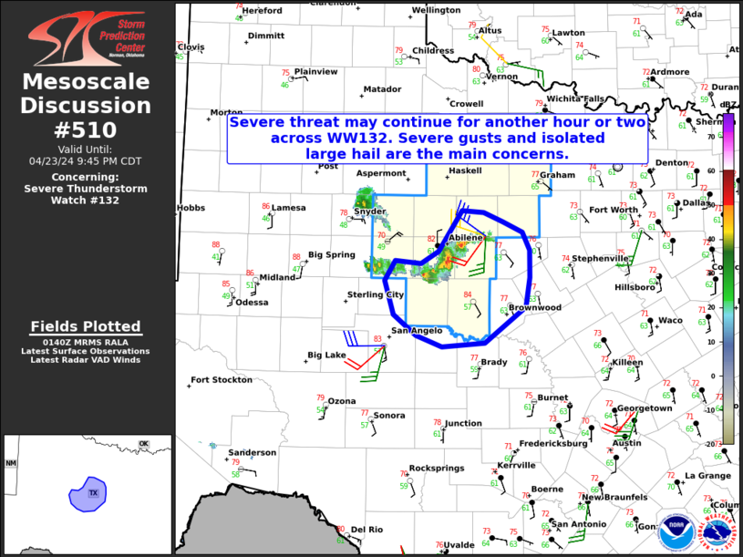
MD 0510 CONCERNING SEVERE THUNDERSTORM WATCH 132… FOR PORTIONS OF NORTHWEST INTO CENTRAL TEXAS
Mesoscale Discussion 0510
NWS Storm Prediction Center Norman OK
0842 PM CDT Tue Apr 23 2024
Areas affected…Portions of Northwest into Central Texas
Concerning…Severe Thunderstorm Watch 132…
Valid 240142Z – 240245Z
The severe weather threat for Severe Thunderstorm Watch 132
continues.
SUMMARY…Severe gusts and isolated large hail remain possible for
the next hour or two in Northwest/Central Texas.
DISCUSSION…A locally upscale-grown cluster (with embedded
supercell structures) has evolved over Northwest TX this evening,
and will continue tracking southeastward during the next 1-2 hours.
Given the slightly larger cold pool that has developed on the
eastern periphery of a steep low-level lapse-rate plume, severe
gusts up to 65 mph are the main concern. Isolated large hail is also
possible in the deeper embedded cores. This storm cluster is moving
into increasing MLCINH owing to the onset of nocturnal
boundary-layer cooling, and the severe risk should generally weaken
with time. Convective trends are being monitored for a local spatial
extension of Severe Thunderstorm Watch 132, though this is not
currently expected for reasons above.
..Weinman.. 04/24/2024
…Please see www.spc.noaa.gov for graphic product…
ATTN…WFO…FWD…SJT…
LAT…LON 31700038 32050049 32260036 32240004 32379983 32799953
32789927 32689902 32579879 32389869 32099870 31779875
31399925 31369979 31480011 31700038