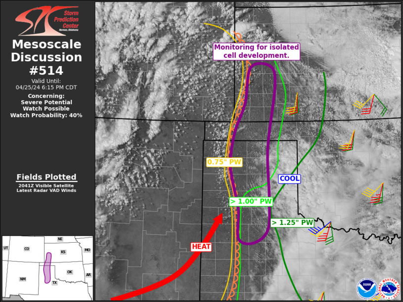
MD 0514 CONCERNING SEVERE POTENTIAL…WATCH POSSIBLE FOR SOUTHWEST KANSAS INTO THE CENTRAL TEXAS PANHANDLE
Mesoscale Discussion 0514
NWS Storm Prediction Center Norman OK
0347 PM CDT Thu Apr 25 2024
Areas affected…southwest Kansas into the central Texas Panhandle
Concerning…Severe potential…Watch possible
Valid 252047Z – 252315Z
Probability of Watch Issuance…40 percent
SUMMARY…A narrow zone of isolated storm potential exists from
southwest Kansas into the central Texas Panhandle, with conditional
supercell threat.
DISCUSSION…Clouds hampered heating for much of the day from the
South Plains into most of the TX Panhandle, but boundary layer
mixing continues with decreasing clouds. High-based cumulus have
formed within the warmer, deeply mixed air mass just west of the
dryline, with signs of increasing warm sector cumulus as well.
Special midday soundings from AMA and DDC show steep lapse rates
aloft and strong mid and high level winds. While dewpoints have
dropped in some areas such as western KS, GPS water vapor sensors
indicate greater overall moisture content roughly from AMA
southeastward toward CDS.
Given continued cloud erosion, mixing along the dryline, and an
increasing low-level jet into the evening, isolated severe storms
cannot be ruled out within this narrow north-south zone.
..Jewell/Hart.. 04/25/2024
…Please see www.spc.noaa.gov for graphic product…
ATTN…WFO…DDC…GLD…LUB…AMA…
LAT…LON 33910188 34670189 35470209 35970215 36730202 37480168
38410150 38450086 37940070 36300094 34960091 34160096
33810139 33910188
