
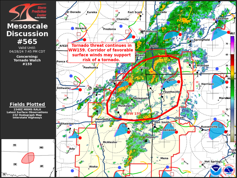
MD 0565 CONCERNING TORNADO WATCH 159… FOR NORTHEAST OKLAHOMA…NORTHWESTERN ARKANSAS…AND SOUTHWESTERN MISSOURI
Mesoscale Discussion 0565
NWS Storm Prediction Center Norman OK
0650 PM CDT Sun Apr 28 2024
Areas affected…Northeast Oklahoma…Northwestern Arkansas…and
Southwestern Missouri
Concerning…Tornado Watch 159…
Valid 282350Z – 290045Z
The severe weather threat for Tornado Watch 159 continues.
SUMMARY…Tornado threat continues in WW159. Corridor of more
favorable surface winds may support risk of a tornado.
DISCUSSION…Recent surface observations indicate winds across
northwestern Arkansas into southwestern Missouri are backing as
convection approaches from the south and west. This southeasterly
component has not handled well by recent RAP analysis data, which
may indicate low-level shear is more favorable across this corridor
than indicated in recent guidance. The VAD profile from KSRX (Fort
Smith WSR-88D) shows around 250-300 m2/s2 0-1km SRH. This area may
be a focused zone of potential for a tornado in the short term.
..Thornton/Smith.. 04/28/2024
…Please see www.spc.noaa.gov for graphic product…
ATTN…WFO…SGF…TSA…
LAT…LON 35799375 35519434 35489468 35479497 35509544 35619566
35859568 36089554 36249541 36569509 36789472 36899431
36909392 36839371 36579365 36309362 36089367 35799375