
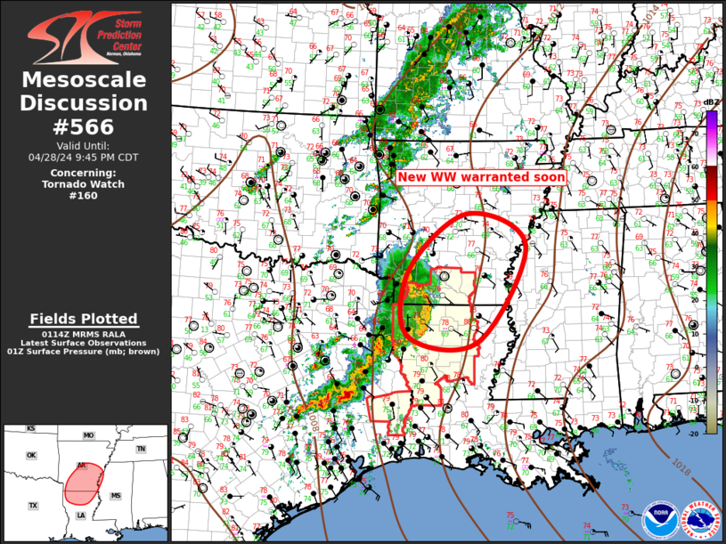
MD 0566 CONCERNING TORNADO WATCH 160… FOR LOWER MISSISSIPPI VALLEY
Mesoscale Discussion 0566
NWS Storm Prediction Center Norman OK
0816 PM CDT Sun Apr 28 2024
Areas affected…Lower Mississippi Valley
Concerning…Tornado Watch 160…
Valid 290116Z – 290245Z
The severe weather threat for Tornado Watch 160 continues.
SUMMARY…Severe squall line will advance beyond ww160,
necessitating the need for a new ww immediately downstream.
DISCUSSION…Upscale growth continues with MCS as it propagates
across the Ark-La-TX early this evening. Leading edge of surging bow
is approaching ELD, and damaging winds will be common with this
squall line. Given the expanding precip shield and cold pool,
forward momentum should easily allow this complex to advance beyond
ww160 across southern AR. Shear profiles favor supercells, but the
primary storm mode will likely remain an MCS. Even so, tornadoes
remain possible with embedded circulations, along with any discrete
structures that could evolve independent of this MCS.
..Darrow.. 04/29/2024
…Please see www.spc.noaa.gov for graphic product…
ATTN…WFO…MEG…JAN…LZK…SHV…
LAT…LON 33749366 34949217 34269068 32219190 32339367 33749366