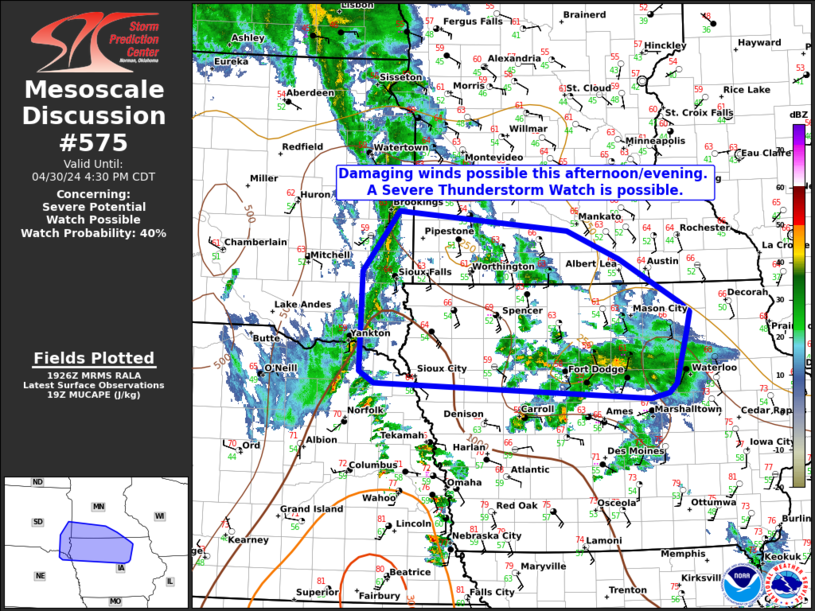
MD 0575 CONCERNING SEVERE POTENTIAL…WATCH POSSIBLE FOR PARTS OF EASTERN SOUTH DAKOTA…NORTHERN IOWA AND SOUTHERN MINNESOTA
Mesoscale Discussion 0575
NWS Storm Prediction Center Norman OK
0229 PM CDT Tue Apr 30 2024
Areas affected…parts of eastern South Dakota…Northern Iowa and
southern Minnesota
Concerning…Severe potential…Watch possible
Valid 301929Z – 302130Z
Probability of Watch Issuance…40 percent
SUMMARY…Scattered thunderstorms over eastern SD may grow upscale
into a more organized line/cluster with time. Damaging winds and
hail are possible, but the coverage and severity are uncertain. A
Severe Thunderstorm Watch is possible.
DISCUSSION…Ahead of the advancing shortwave trough, thunderstorms
have initiated along a pre-frontal trough/convergence zone across
parts of eastern SD and northeastern NE. North of a modifying
outflow boundary/effective warm front, the air mass has slowly
moistened and warmed into the low 60s F. While not overly unstable,
heating through scattered cloud breaks and further moistening will
continue to allow for destabilization with SPC mesoanalysis showing
~500-1000 J/kg of MUCAPE. Effective straight-line hodographs will
favor a linear/cluster mode with further upscale growth from storm
interactions likely. Given the storm mode and modest buoyancy,
damaging winds appear to be the most likely threat. However,
occasional hail and a brief tornado will also be possible with any
embedded supercell/bowing structures able to develop. Buoyancy
decreases farther east indicating some uncertainty on the coverage
and timing of the severe risk. Still, mesoscale trends suggest
further destabilization is likely and a downstream severe risk may
develop. With this in mind, a Severe Thunderstorm Watch is possible.
..Lyons/Hart.. 04/30/2024
…Please see www.spc.noaa.gov for graphic product…
ATTN…WFO…ARX…MPX…DMX…FSD…OAX…
LAT…LON 42249290 42419701 42539722 43629719 44289665 44089414
43779337 43299248 43179231 42969236 42399253 42309263
42249290
