
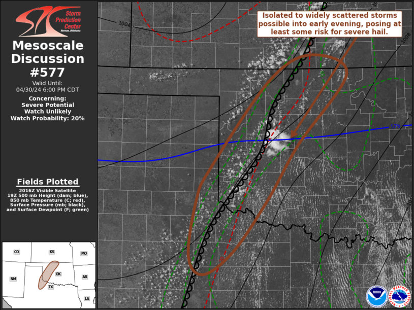
MD 0577 CONCERNING SEVERE POTENTIAL…WATCH UNLIKELY FOR WESTERN OKLAHOMA INTO NORTHWESTERN TEXAS
Mesoscale Discussion 0577
NWS Storm Prediction Center Norman OK
0324 PM CDT Tue Apr 30 2024
Areas affected…western Oklahoma into northwestern Texas
Concerning…Severe potential…Watch unlikely
Valid 302024Z – 302300Z
Probability of Watch Issuance…20 percent
SUMMARY…Isolated to widely scattered thunderstorm development is
possible late this afternoon and evening. While stronger cells may
pose a risk for severe hail, they may not be particularly
long-lived. While the need for a severe weather watch is not
currently anticipated, trends will continue to be monitored.
DISCUSSION…Deepening convection, including at least attempts at
thunderstorm initiation, is underway near the dryline across western
Oklahoma into northwestern Texas. However, mid/upper support for
thunderstorm development appears likely to remain weak to
negligible, while inhibition associated with warming elevated
mixed-layer air spreading east of the southern Rockies continues to
increase. With the dryline also forecast to tend to slowly retreat
westward/northwestward into this evening, the potential for
sustained thunderstorm development appears generally low, but an
isolated storm or two could briefly develop and intensify. In an
environment conditionally supportive of supercells, large hail
appears the primary potential severe hazard before the storms
dissipate.
..Kerr/Hart.. 04/30/2024
…Please see www.spc.noaa.gov for graphic product…
ATTN…WFO…ICT…OUN…DDC…LUB…AMA…
LAT…LON 36779887 37259794 36909710 35619821 34599892 33669966
33240031 33580063 34600048 35170017 36779887