
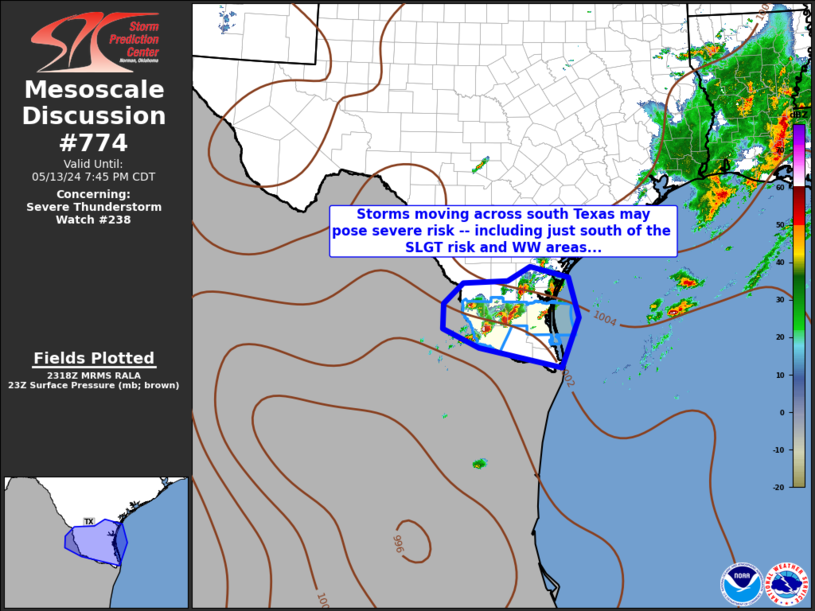
MD 0774 CONCERNING SEVERE THUNDERSTORM WATCH 238… FOR DEEP SOUTH TEXAS
Mesoscale Discussion 0774
NWS Storm Prediction Center Norman OK
0620 PM CDT Mon May 13 2024
Areas affected…Deep South Texas
Concerning…Severe Thunderstorm Watch 238…
Valid 132320Z – 140045Z
The severe weather threat for Severe Thunderstorm Watch 238
continues.
SUMMARY…Strong/locally severe storms continue across Deep South
Texas in/near WW 238. Expansion area of the WW may be appropriate,
given potential for storms to exit the WW.
DISCUSSION…Latest radar loop shows strong storms crossing Deep
South Texas, largely within WW 238. However, a few storms — which
have produced hail up to golfball size recently — may near/move out
of the southeastern fringe of the watch. With a favorably unstable
environment near/south of the front, a focus for ascent, and
deep-layer shear supporting rotating storms, expect risk for large
hail and damaging winds to continue. This suggests consideration
for an extension of the WW to cover additional counties within the
WFO Brownsville area along the river, not currently in the watch.
..Goss.. 05/13/2024
…Please see www.spc.noaa.gov for graphic product…
ATTN…WFO…CRP…BRO…
LAT…LON 26719988 27229986 27649943 27689841 27989790 27769704
26949680 25939720 26329906 26719988