
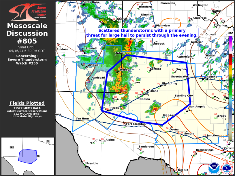
MD 0805 CONCERNING SEVERE THUNDERSTORM WATCH 250… FOR EASTERN NEW MEXICO INTO WEST TEXAS
Mesoscale Discussion 0805
NWS Storm Prediction Center Norman OK
0455 PM CDT Thu May 16 2024
Areas affected…eastern New Mexico into West Texas
Concerning…Severe Thunderstorm Watch 250…
Valid 162155Z – 162330Z
The severe weather threat for Severe Thunderstorm Watch 250
continues.
SUMMARY…Threat for primarily large hail to continue into the
evening.
DISCUSSION…Elevated thunderstorms have formed atop the
outflow/composite front across eastern New Mexico/West Texas. These
storms have shown some supercell structures but have not been overly
organized or robust thus far. This is likely due to only moderate
MUCAPE (1000 to 1500 J/kg) and deep-layer shear. While fixed-layer
0-6 shear would appear favorable, the inflow base on these storms is
likely around 2km. 2-8km shear is only around 25 to 30 knots (per
MAF VWP). This likely explains some of the somewhat sporadically
organized nature of the convection. The storms farther south and
east, closer to the better elevated instability (and 30-35 knots of
effective shear per SJT VWP), are more robust and will likely pose
the greatest large and potentially very large hail through the
evening.
..Bentley/Smith.. 05/16/2024
…Please see www.spc.noaa.gov for graphic product…
ATTN…WFO…SJT…LUB…MAF…
LAT…LON 31390380 32680360 33250285 32990048 31610036 30920145
31030230 31390380