
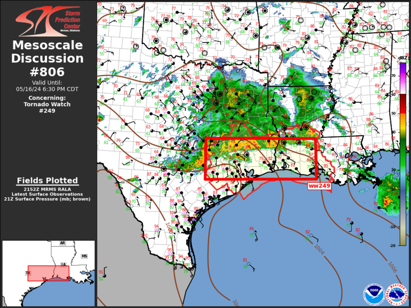
MD 0806 CONCERNING TORNADO WATCH 249… FOR SOUTHEAST TX…SOUTHERN LA
Mesoscale Discussion 0806
NWS Storm Prediction Center Norman OK
0456 PM CDT Thu May 16 2024
Areas affected…Southeast TX…Southern LA
Concerning…Tornado Watch 249…
Valid 162156Z – 162330Z
The severe weather threat for Tornado Watch 249 continues.
SUMMARY…Severe threat will gradually spread southeast across ww249
this evening. Damaging squall line may ultimately evolve over the
next few hours.
DISCUSSION…Expansive MCS has evolved over much of central/east TX
late this afternoon. Leading edge of this activity exhibits numerous
robust updrafts, extending from ACP-JAS-CLL-3T5. MESH data suggests
marginally severe hail is likely observed with the strongest cores,
but convective outflow is likely undercutting much of this activity.
As the cold pool continues to expand, there is reason to believe one
or more bow-type surges could evolve then propagate across the upper
TX Coastal Plain toward the lower Sabine River Valley. Latest radar
data suggests a developing bow is beginning to accelerate into the
northwestern portions of ww249. This squall line may grow upscale
and become more efficient in producing damaging winds as it
progresses across a very warm/moist air mass immediately downstream.
..Darrow.. 05/16/2024
…Please see www.spc.noaa.gov for graphic product…
ATTN…WFO…LCH…HGX…FWD…EWX…
LAT…LON 30969684 30969189 29389189 29369683 30969684