
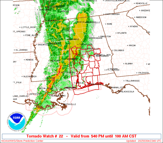
WW 22 TORNADO AL FL MS CW 120740Z – 121500Z
URGENT – IMMEDIATE BROADCAST REQUESTED
Tornado Watch Number 22
NWS Storm Prediction Center Norman OK
140 AM CST Mon Feb 12 2024
The NWS Storm Prediction Center has issued a
* Tornado Watch for portions of
Southern Alabama
Florida Panhandle
Southeast Mississippi
Coastal Waters
* Effective this Monday morning from 140 AM until 900 AM CST.
* Primary threats include…
A few tornadoes possible
Scattered damaging wind gusts to 65 mph possible
Isolated large hail events to 1.5 inches in diameter possible
SUMMARY…The potential for severe thunderstorms including
supercells is expected to increase overnight as low-level
atmospheric winds strengthen and additional destabilization occurs.
These storms will pose a tornado/damaging wind risk along with
isolated severe hail.
The tornado watch area is approximately along and 70 statute miles
north and south of a line from 40 miles north of Gulfport MS to 35
miles east of Troy AL. For a complete depiction of the watch see the
associated watch outline update (WOUS64 KWNS WOU2).
PRECAUTIONARY/PREPAREDNESS ACTIONS…
REMEMBER…A Tornado Watch means conditions are favorable for
tornadoes and severe thunderstorms in and close to the watch
area. Persons in these areas should be on the lookout for
threatening weather conditions and listen for later statements
and possible warnings.
&&
AVIATION…Tornadoes and a few severe thunderstorms with hail
surface and aloft to 1.5 inches. Extreme turbulence and surface wind
gusts to 55 knots. A few cumulonimbi with maximum tops to 500. Mean
storm motion vector 24035.
…Guyer