
MD 0521 CONCERNING SEVERE THUNDERSTORM WATCH 135… FOR TEXAS SOUTH PLAINS AND NORTHWEST TEXAS VICINITY
Mesoscale Discussion 0521
NWS Storm Prediction Center Norman OK
1230 AM CDT Fri Apr 26 2024
Areas affected…Texas South Plains and Northwest Texas vicinity
Concerning…Severe Thunderstorm Watch 135…
Valid 260530Z – 260730Z
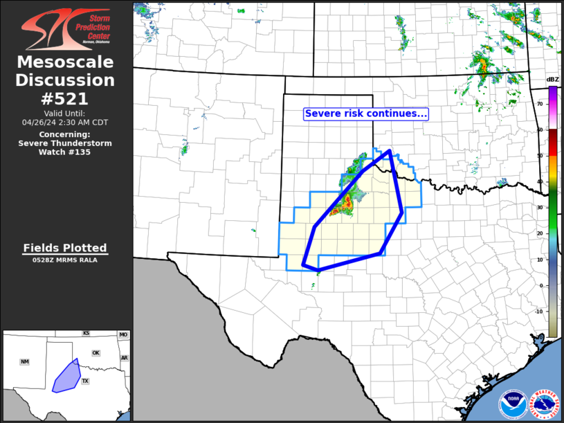
The severe weather threat for Severe Thunderstorm Watch 135
continues.
SUMMARY…Severe risk continues across WW 135.
DISCUSSION…A cluster of strong/severe storms is currently moving
across the Texas South Plains region, per recent radar composite
loop. The convection — within a zone of QG ascent associated with
a subtle short-wave trough moving out of eastern New Mexico — is
forecast to continue advancing northeastward across Northwest Texas
toward the Red River Valley.
Abundant (in excess of 2000 J/kg) CAPE is present across this area,
atop a weakly stable boundary layer. This, along with sufficient
cloud-layer shear for organized/severe storms, suggests that risk
for large hail will continue over the next several hours. Locally
damaging wind gusts will also be possible, particularly if
convection expands to form an organized cold pool.
..Goss.. 04/26/2024
…Please see www.spc.noaa.gov for graphic product…
ATTN…WFO…OUN…SJT…LUB…MAF…
LAT…LON 31800227 32860192 34390035 34969944 33259906 32139978
31660179 31800227