
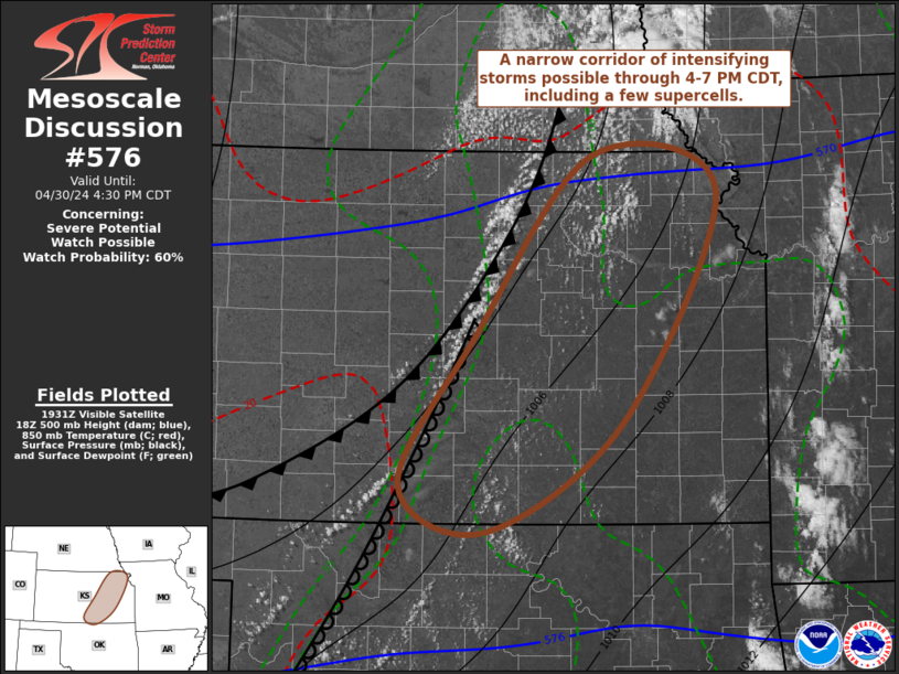
MD 0576 CONCERNING SEVERE POTENTIAL…WATCH POSSIBLE FOR PARTS OF EASTERN KANSAS
Mesoscale Discussion 0576
NWS Storm Prediction Center Norman OK
0235 PM CDT Tue Apr 30 2024
Areas affected…parts of eastern Kansas
Concerning…Severe potential…Watch possible
Valid 301935Z – 302130Z
Probability of Watch Issuance…60 percent
SUMMARY…Intensifying thunderstorm development is probable through
4-7 PM CDT, including a few supercells with potential to produce
large hail, locally damaging wind gusts and a risk for tornadoes.
DISCUSSION…To the south of a strong, broadly cyclonic mid/upper
jet nosing east of the Front Range, toward the the middle Missouri
Valley, warm elevated mixed-layer air remains inhibitive to
convective development in the presence of weak to negligible
mid/upper forcing for ascent. However, where the cold front is
overtaking a sharpening dryline across the Salina vicinity of north
central Kansas, more notable deepening of convective development is
ongoing.
Aided by a corridor of stronger pre-frontal boundary-layer heating,
including surface temperatures exceeding 90F along an axis across
northwestern Oklahoma into the Salina vicinity, mixed-layer CAPE now
appears in excess of 2000 J/kg along the sharpening dryline. With
additional insolation, it appears that low-level forcing near the
cold front/dryline intersection may become sufficient to support
sustained thunderstorm development as early as 21-22Z. In the
presence of moderate but veering flow with height in the 850-500 mb
layer, vertical shear will be conducive to supercell development, at
least initially, and perhaps an upscale growing line with
persistent supercell development along its southern flank, gradually
approaching the Wichita area through early evening.
..Kerr/Hart.. 04/30/2024
…Please see www.spc.noaa.gov for graphic product…
ATTN…WFO…EAX…TOP…ICT…OUN…DDC…
LAT…LON 38499761 39979640 39699511 37819607 36929748 37309836
38499761