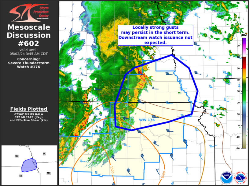
MD 0602 CONCERNING SEVERE THUNDERSTORM WATCH 176… FOR PORTIONS OF SOUTHEAST NE…NORTHEAST KS AND ADJACENT PORTIONS OF IA/MO
Mesoscale Discussion 0602
NWS Storm Prediction Center Norman OK
0238 AM CDT Thu May 02 2024
Areas affected…portions of southeast NE…northeast KS and
adjacent portions of IA/MO
Concerning…Severe Thunderstorm Watch 176…
Valid 020738Z – 020845Z
The severe weather threat for Severe Thunderstorm Watch 176
continues.
SUMMARY…Locally strong gusts are possible in the short term across
southeast Nebraska into northeast Kansas. Overall severe potential
is expected to diminish with time/extent over the next 1-2 hours.
DISCUSSION…A leading thunderstorm cluster across southeast NE/far
northeast KS will continue to pose a risk for locally strong gusts
over the next hour. This activity is moving into an airmass with
dewpoints in the upper 40s F and rapidly weakening instability. The
expectation is that convection will begin to weaken with
time/eastward extent over the next 1-2 hours. As such, a downstream
watch is not expected into southwest IA/northwest MO.
Additional convective lines/clusters further west over north-central
KS are behind outflow from eastern convection. This activity is not
expected to pose much severe risk, through gusts to 45 mph are
possible.
..Leitman.. 05/02/2024
…Please see www.spc.noaa.gov for graphic product…
ATTN…WFO…EAX…OAX…TOP…GID…
LAT…LON 40869717 41179595 40849538 40289511 39719531 39529605
39309724 39399775 39939778 40689745 40869717
