
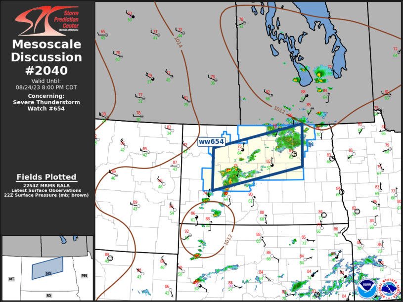
MD 2040 CONCERNING SEVERE THUNDERSTORM WATCH 654… FOR NORTH DAKOTA
Mesoscale Discussion 2040
NWS Storm Prediction Center Norman OK
0556 PM CDT Thu Aug 24 2023
Areas affected…North Dakota
Concerning…Severe Thunderstorm Watch 654…
Valid 242256Z – 250100Z
The severe weather threat for Severe Thunderstorm Watch 654
continues.
SUMMARY…Severe threat continues across ww654 this evening.
DISCUSSION…Upper ridge is beginning to flatten across ND ahead of
SK short-wave trough. Scattered convection has developed well ahead
of this feature along a weak surface front, but is not particularly
organized, though some clustering is noted with storms over
southwestern portions of ww654. Latest MRMS data suggests the most
robust updrafts are generating some hail, but mostly less than one
inch in diameter. Given the steep lapse rate environment, and modest
buoyancy, some upscale growth may be possible
Large-scale forcing should encourage convection to spread across
northeastern ND into northwestern MN later this evening. Given the
strong westerly flow some of this activity could be organized.
..Darrow.. 08/24/2023
…Please see www.spc.noaa.gov for graphic product…
ATTN…WFO…FGF…BIS…
LAT…LON 48290260 49039852 47739853 46990261 48290260