
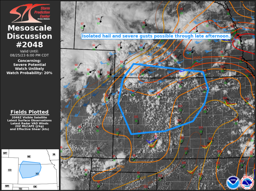
MD 2048 CONCERNING SEVERE POTENTIAL…WATCH UNLIKELY FOR WESTERN KS INTO EXTREME SOUTHERN NE
Mesoscale Discussion 2048
NWS Storm Prediction Center Norman OK
0354 PM CDT Fri Aug 25 2023
Areas affected…Western KS into extreme southern NE
Concerning…Severe potential…Watch unlikely
Valid 252054Z – 252300Z
Probability of Watch Issuance…20 percent
SUMMARY…Storms capable of hail and isolated severe gusts may
increase through late afternoon.
DISCUSSION…Storms are gradually increasing in coverage this
afternoon from southwest NE into northwest KS, near/north of a
surface low near the CO/KS state line. Thus far, the strongest
storms have been to the cool side of a surface boundary across
extreme southwest NE, where otherwise-weak deep-layer shear is
slightly stronger due to surface northeasterly winds. Occasional
strong multicells in this region may pose an isolated hail and
severe gusts threat through the afternoon.
Additional deepening cumulus is noted within the hot/well-mixed
environment south of the surface boundary into a larger portion of
western KS. As storms deepen/mature within this regime, inverted-V
profiles will support a threat of isolated severe downbursts through
late afternoon. Outflow consolidation may eventually result in a
loosely organized cluster, but the short-term threat is expected to
remain disorganized and rather isolated, rendering watch issuance
unlikely.
..Dean/Thompson.. 08/25/2023
…Please see www.spc.noaa.gov for graphic product…
ATTN…WFO…TOP…ICT…GID…LBF…DDC…GLD…
LAT…LON 37900120 39040184 39940165 40510114 40219778 39559755
39019775 38399831 38039963 37980047 37900120