
MD 2135 CONCERNING SEVERE POTENTIAL…WATCH UNLIKELY FOR SOUTHERN NEW MEXICO INTO FAR WEST TEXAS
Mesoscale Discussion 2135
NWS Storm Prediction Center Norman OK
0309 PM CDT Sun Sep 28 2025
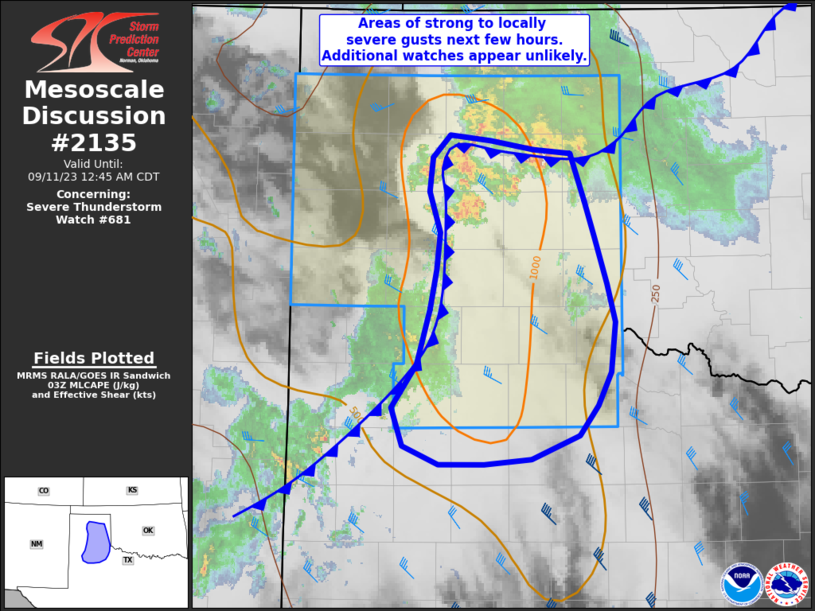
Areas affected...southern New Mexico into Far West Texas
Concerning...Severe potential...Watch unlikely
Valid 282009Z - 282245Z
Probability of Watch Issuance...20 percent
SUMMARY...Scattered storms, some with hail, will persist over parts
of southern New Mexico and Far West Texas. A few severe storms
affecting the El Paso area cannot be ruled out mainly after 00Z.
DISCUSSION...Heating of a moist air mass beneath cool midlevels with
the upper trough has lead to scattered midday cells, some possibly
producing hail to near 1.00" diameter. Deep-layer shear is generally
at or below 30 kt, but the favorable/early time of day with several
hours of heating suggests additional storms will redevelop.
While the El Paso area is currently west of the existing batch of
cells, satellite and radar imagery show new development over the
northern Sierra Madre in northern Mexico. In addition, cells are
developing over the higher terrain over southwest NM.
Given such strong heating over southwest NM into northern Mexico, it
is possible these cells survive as they travel northeastward across
the lower terrain. Shear is not particularly strong, but at least
some semblance of cells or perhaps propagating/outflow induced
convection may push into south-central NM and the El Paso vicinity
near or after 00Z. Gusty winds and marginal hail would be possible.
..Jewell/Mosier.. 09/28/2025
...Please see www.spc.noaa.gov for graphic product...
ATTN...WFO...MAF...ABQ...EPZ...
LAT...LON 30250481 29790662 30330730 30540821 31300874 32190813
32710793 33170785 33340741 33360670 33130594 32810551
32280509 31430468 30250481
MOST PROBABLE PEAK WIND GUST...UP TO 60 MPH
MOST PROBABLE PEAK HAIL SIZE...UP TO 1.25 IN