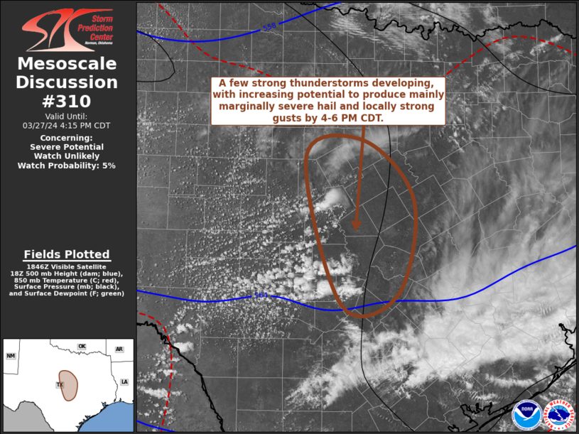
MD 0310 CONCERNING SEVERE POTENTIAL…WATCH UNLIKELY FOR PARTS OF CENTRAL TEXAS
Mesoscale Discussion 0310
NWS Storm Prediction Center Norman OK
0152 PM CDT Wed Mar 27 2024
Areas affected…parts of central Texas
Concerning…Severe potential…Watch unlikely
Valid 271852Z – 272115Z
Probability of Watch Issuance…5 percent
SUMMARY…The risk for a few strong thunderstorms with potential to
produce severe hail and locally strong surface gusts appears likely
to increase by 4-6 PM CDT.
DISCUSSION…Beneath cold air (including 500 mb temperatures around
-23 to -26 C) associated with mid-level troughing shifting across
the southern Great Plains, a deepening well-mixed boundary-layer
continues to evolve with daytime heating across the Edwards Plateau
into Hill Country. Near the leading edge of the stronger
differential surface heating, where surface dew points are still as
high as the mid/upper 40s F, destabilization is contributing to
deepening convective development, within moderately sheared westerly
to west-northwesterly deep-layer mean flow.
With additional insolation, it appears that mixed-layer CAPE may
increase in excess of 500 J/kg. As the sharp trailing flank of the
mid-level cold pool begins to progress east-northeast of the Permian
Basin, strongest instability is forecast to shift toward the I-35
corridor of central Texas through 21-23Z, where/when initiation and
intensification of thunderstorm activity appear increasingly
probable, perhaps aided by ascent associated with low-level warm
advection.
Given the evolving thermodynamic profiles and favorable deep-layer
shear, a few supercell structures may develop and pose a risk for
producing severe hail and locally strong surface gusts through early
evening, before weakening.
..Kerr/Hart.. 03/27/2024
…Please see www.spc.noaa.gov for graphic product…
ATTN…WFO…FWD…EWX…SJT…
LAT…LON 32339814 31519735 30239760 30089850 32119908 32339814
