
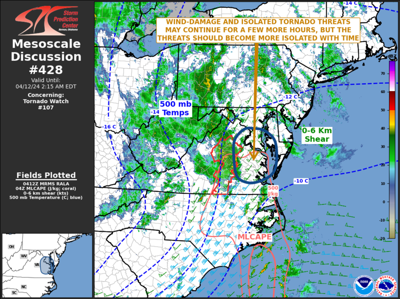
MD 0428 CONCERNING TORNADO WATCH 107… FOR EASTERN VIRGINIA…SOUTHERN MARYLAND
Mesoscale Discussion 0428
NWS Storm Prediction Center Norman OK
1115 PM CDT Thu Apr 11 2024
Areas affected…Eastern Virginia…Southern Maryland
Concerning…Tornado Watch 107…
Valid 120415Z – 120615Z
The severe weather threat for Tornado Watch 107 continues.
SUMMARY…An isolated wind damage and tornado threat will likely
continue for a few more hours across eastern Virginia. The threat
may eventually affect southern Maryland, but the need for another
watch is unclear.
DISCUSSION…An upper-level trough and an associated 80 to 100 knot
mid-level jet, will move through Carolinas early tonight. Ahead of
the trough, a 60 to 70 knot low-level jet will continue from eastern
North Carolina into eastern Virginia and southern Maryland. A line
of strong to severe thunderstorms, ongoing to the northwest of
Wakefield, Virginia, will move eastward toward the low-level jet
over the next couple of hours. RAP forecast soundings across eastern
Virginia from 05Z to 06Z have 0-6 km shear near 60 knots, and 0-3 km
storm-relative helicity in the 250 to 350 m2/s2 range. This
environment will support an isolated tornado and wind-damage threat
with low-topped supercells, however recent trends suggest that the
cloud tops have warmed, and lightning flash rates have come down.
Although the severe threat should spread northeastward into southern
Maryland early tonight, the threat should be marginal.
..Broyles.. 04/12/2024
…Please see www.spc.noaa.gov for graphic product…
ATTN…WFO…PHI…AKQ…LWX…
LAT…LON 38477588 38867634 38967685 38937731 38527775 37867777
37267765 37037736 36977682 37237608 37697583 38477588