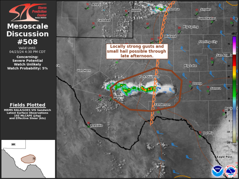
MD 0508 CONCERNING SEVERE POTENTIAL…WATCH UNLIKELY FOR TRANS-PECOS/LOWER PECOS VALLEY OF TX
Mesoscale Discussion 0508
NWS Storm Prediction Center Norman OK
0256 PM CDT Tue Apr 23 2024
Areas affected…Trans-Pecos/Lower Pecos Valley of TX
Concerning…Severe potential…Watch unlikely
Valid 231956Z – 232130Z
Probability of Watch Issuance…5 percent
SUMMARY…Localized strong to severe gusts of 50-65 mph and small to
marginally severe hail to around 1 inch in diameter will be possible
with a couple storms in far west Texas.
DISCUSSION…High-based, lower-topped thunderstorms are expected to
persist for a few more hours off the higher terrain of the TX
Trans-Pecos and spread east towards the Lower Pecos Valley before
weakening. Steep lower-level lapse rates will be conductive to
microbursts beneath generally small hail cores aloft. The overall
environmental setup coupled with the lack of stronger large-scale
ascent suggest that any severe threat should remain relatively
localized in space/short in time, and marginal in intensity.
..Grams/Smith.. 04/23/2024
…Please see www.spc.noaa.gov for graphic product…
ATTN…WFO…EWX…SJT…MAF…
LAT…LON 30800352 31180233 31110184 30840152 30280160 30140176
30020246 30060315 30350368 30640376 30800352
