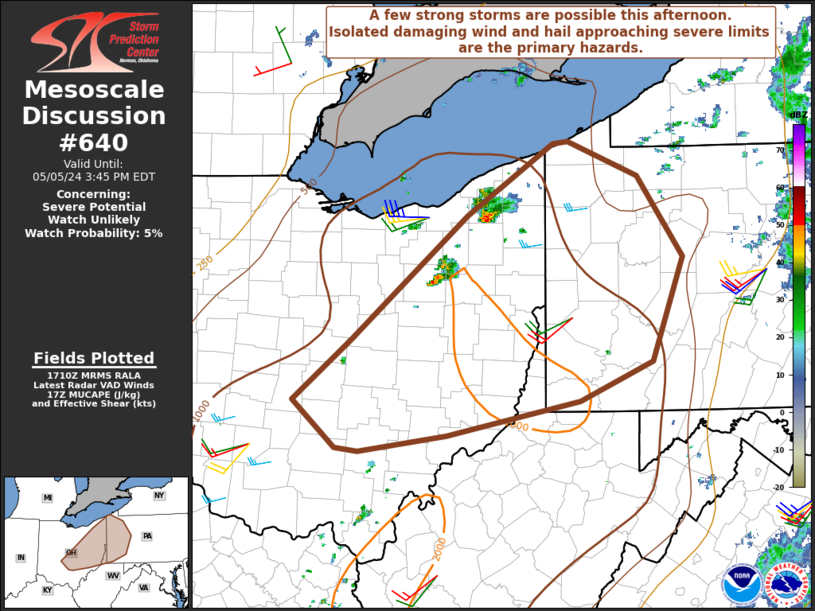
MD 0640 CONCERNING SEVERE POTENTIAL…WATCH UNLIKELY FOR CENTRAL/EASTERN OH…WESTERN PA…NORTHERN WV PANHANDLE
Mesoscale Discussion 0640
NWS Storm Prediction Center Norman OK
1212 PM CDT Sun May 05 2024
Areas affected…Central/eastern OH…western PA…northern WV
Panhandle
Concerning…Severe potential…Watch unlikely
Valid 051712Z – 051945Z
Probability of Watch Issuance…5 percent
SUMMARY…A few strong storms are possible this afternoon. Isolated
damaging wind is expected to be the primary threat, along with hail
approaching severe limits.
DISCUSSION…A couple of storms have recently developed along a cold
front across northeast OH. Modest heating of a relatively moist
environment will support moderate destabilization (MLCAPE generally
1000-1500 J/kg) along/ahead of the cold front this afternoon. While
stronger ascent associated with a shortwave trough over parts of
Ontario and Quebec will stay north of the region, weakening CINH
will support some increase in storm coverage with time.
With only modest midlevel flow across the region, effective shear is
expected to remain relatively weak (generally 20-25 kt), and storms
will likely struggle to become organized. However, a few stronger
multicells could eventually evolve with time. Locally gusty winds
will be possible with the stronger cells, especially where stronger
heating occurs this afternoon. Also, despite the weak deep-layer
shear, moderate buoyancy and relatively cool temperatures aloft will
support potential for small to near-severe hail.
..Dean/Smith.. 05/05/2024
…Please see www.spc.noaa.gov for graphic product…
ATTN…WFO…CTP…PBZ…RLX…CLE…ILN…
LAT…LON 39808335 40328271 41408140 42028042 42048025 41757947
41057895 40147930 39808013 39518163 39368262 39408287
39808335
