
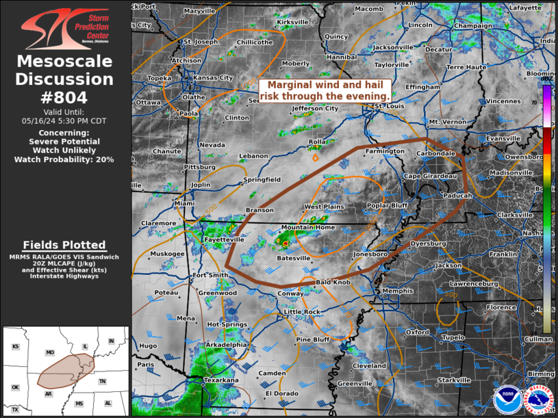
MD 0804 CONCERNING SEVERE POTENTIAL…WATCH UNLIKELY FOR NORTHERN ARKANSAS…SOUTH EASTERN MISSOURI…SOUTHERN ILLINOIS…FAR WESTERN KENTUCKY
Mesoscale Discussion 0804
NWS Storm Prediction Center Norman OK
0325 PM CDT Thu May 16 2024
Areas affected…northern Arkansas…south eastern
Missouri…southern Illinois…far western Kentucky
Concerning…Severe potential…Watch unlikely
Valid 162025Z – 162230Z
Probability of Watch Issuance…20 percent
SUMMARY…Marginal wind and hail risk through the evening.
DISCUSSION…Thunderstorm activity is expected to increase in
coverage this afternoon and evening across portions of the Ozarks to
the middle Mississippi Valley. A few more organized clusters and a
supercell or two may be possible as forcing increases from a
mid-level speed max moves across this region later in the evening
amid MLCAPE increasing to around 1000-1500 J/kg. A few instances of
severe hail and damaging wind will be possible. A watch is unlikely
to be needed, as this threat will remain isolated.
..Thornton/Thompson.. 05/16/2024
…Please see www.spc.noaa.gov for graphic product…
ATTN…WFO…PAH…MEG…LSX…LZK…SGF…TSA…
LAT…LON 36659306 37139222 37939057 38098894 37728808 36998802
36698829 36228917 35639031 35439115 35309232 35389291
35669359 36319334 36659306